Live updates: Caseyville nursing home evacuated. Flooding continues in southwest IL
READ MORE
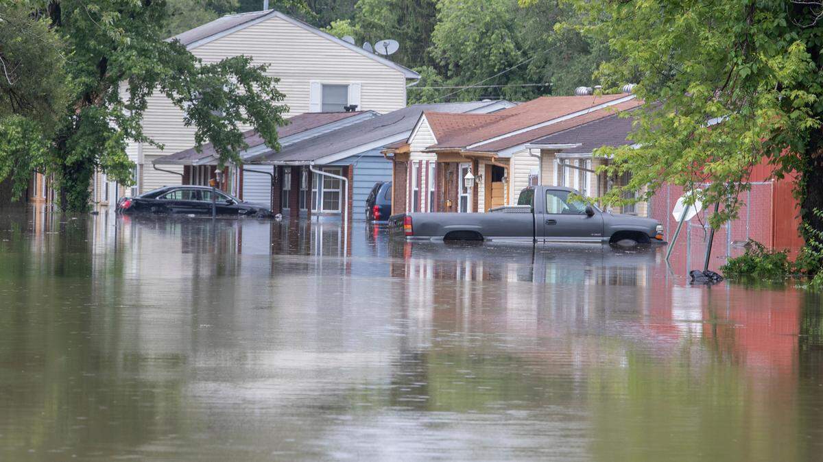
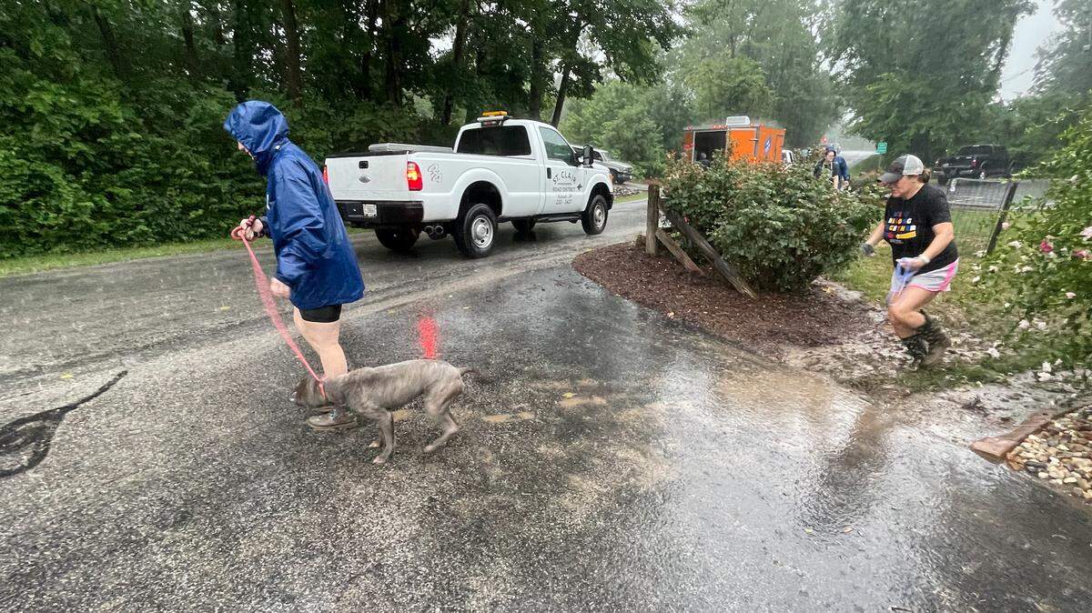
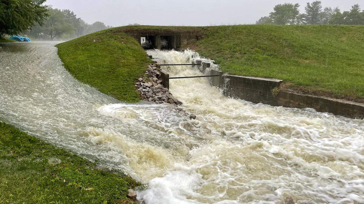
Flash flooding across southwest IL
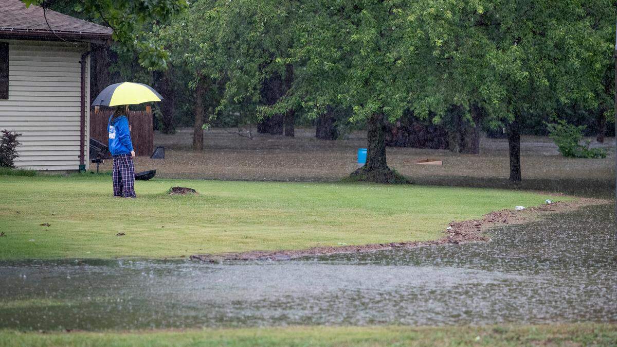
Over 12 inches of rain fell overnight on July 26 in some areas of the St. Louis and southwest Illinois regions, with the National Weather Service in St. Louis reporting “life-threatening flash flooding” in some communities.
Expand All
Over 12 inches of rain fell overnight in some areas of the St. Louis and southwest Illinois regions, leading to at least one death on Tuesday.
The historic rainfall shut down interstates and forced the evacuation of people from their homes. Damage to the MetroLink system may take two weeks or possibly longer to be repaired.
Here’s a roundup of flood news from throughout the day:

6 p.m. Update on Caseyville nursing home evacuation
About 120 residents of the Caseyville Nursing & Rehabilitation Center had to be evacuated after a levee was breached on Tuesday, Caseyville Mayor G.W. Scott Sr. reported.
“We had our hands full,” Scott said of the evacuation at 601 W. Lincoln Ave.
Scott said the residents were being evacuated to other nursing homes and the Caseyville Community Center was used as a staging area.
The water did not enter the nursing home building but it came close to the building. With additional rain in the forecast and the possibility of damage to the sewer system, the decision was made to evacuate the residents, Scott said.
Several residents of homes in the area also had to evacuate to the community center after flooding occurred when the Little Canteen Creek Levee was breached in several areas, Scott said.
A 75-foot section on the south side of the levee was washed out, according to a statement from the police department.
Several streets were closed during the day but by Tuesday evening the only closure was on the lower end of Susanne Court, Scott said.
Scott said he is not sure when repairs could be made to the levee.
The mayor said he is “hoping and praying” that the village is spared further storms this week.
5 p.m. Flood warnings canceled; more rain coming?
The flood warnings for St. Clair and Madison counties expired as of 5 p.m. Tuesday, the National Weather Service of St. Louis confirmed.
“That’s going to be it. We won’t reissue flood warnings for those counties,” Lydia Jaja, a meteorologist with the NWS, said late Tuesday afternoon.
As far as the flood warnings for Clinton and Washington counties, Jaja confirmed those both expired and will not be reissued.
Moving forward, NWS meteorologist Ben Herzog said the metro-east likely will see more rain Wednesday morning. He does not expect anywhere near the same amounts, but, after Tuesday’s storms, any rainfall could be impactful.
“It would not take much to cause problems for people. So be careful if you go out tonight,” he said.
Herzog gauged the rain will move into the metro-east around 2 a.m. Wednesday and end around 9 a.m. As of Tuesday afternoon, he said the highest chance for heavier rain is in Madison County, but stressed that the wiggle room between there and St. Clair County is only 10-15 miles.
“It’s pretty difficult to pin down exactly where the rain will fall. We don’t have that kind of accuracy at this point so that could shift,” he said. “Again, it does not look like we’ll get near as much as last night or that it’ll last nearly as long. But, again, it’s not going to take that much to create more problems.”
Herzog issued this standing precaution, “If people do come across flooded waters don’t drive through them.”
4:30 p.m. O’Fallon reopens all roads
Capt. Dave Matevey of the O’Fallon Police Department reported that all roads in the city have reopened.
No injuries were reported but a few cars stalled in the high waters.
The road closures had included Highway 50 between O’Fallon and Lebanon.
4 p.m. MetroLink repairs may take two weeks or longer
The flood damage to MetroLink equipment, particularly at the Forest Park-DeBaliviere Station, which is the pivotal station where the Red Line and Blue Line connect in St. Louis, may take two weeks or longer to repair, Metro said Tuesday in a statement.
“The damage from this unprecedented flooding event is being assessed, and depending on the extent of the flood damage, it is possible that normal MetroLink service may not be restored for potentially two weeks or longer,” Metro said.
“One train stuck in the floodwaters at the Delmar Loop Station has sustained significant damage,” the agency said.
Riders are experiencing significant delays on Tuesday.
3 p.m. National Weather Service extends flood warning
A flood warning remains in effect until 5 p.m. Tuesday for St. Clair and Madison counties, according to the National Weather Service.
Law enforcement officials reported numerous roads are still closed in the metro-east as of 2:55 p.m., the weather service said.
This flood warning replaced a previous flash flood warning and initially was set to expire at 3 p.m.
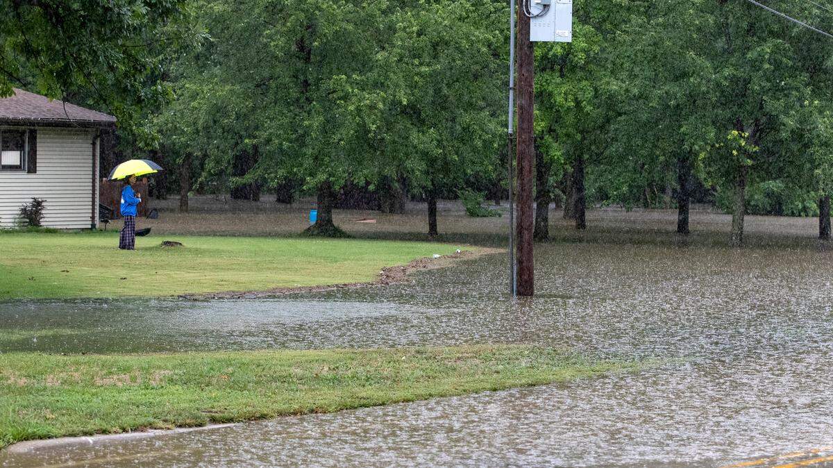
2:30 p.m. Washington Park reports heavy flooding
Washington Park Mayor Leonard Moore said heavy flooding occurred on Bunkum Road and Adelaide Place on Tuesday.
Several cars stalled out in the high water, there were a couple of water rescues and multiple homes had 2 inches of water in the basement, Moore said.
2 p.m. East St. Louis declares disaster
East St. Louis has multiple streets flooded and some residents reported flooded homes on Tuesday, Mayor Robert Eastern III said.
Eastern has declared a flood disaster for the city.
Fire Chief Jason Blackmon said firefighters have rescued 50 people since getting the first call for help at 3:30 a.m.
The city received assistance from Columbia firefighters and from St. Clair County.
1:40 p.m. State police respond to 25 crashes since midnight
Illinois State Police Trooper Joshua Robinson said in a statement that District 11 troopers responded to about 25 traffic crashes and assisted 27 drivers from midnight to 1:36 p.m. Tuesday in the metro-east.
Robinson said the weather was a contributing factor in most of the incidents.
District 11 did not immediately provide details about possible injuries.
1 p.m. Cahokia Heights update
Cahokia Heights Mayor Curtis McCall Sr. said one couple had to be evacuated from their home on Elm Street off Lake Drive on Tuesday but no injuries have been reported.
This is in the part of Centreville that became part of Cahokia Heights last year.
McCall said the Parkside neighborhood was one of the hardest hit sections of Cahokia Heights.
About 10 roads in the town have been filled with floodwaters, he said.
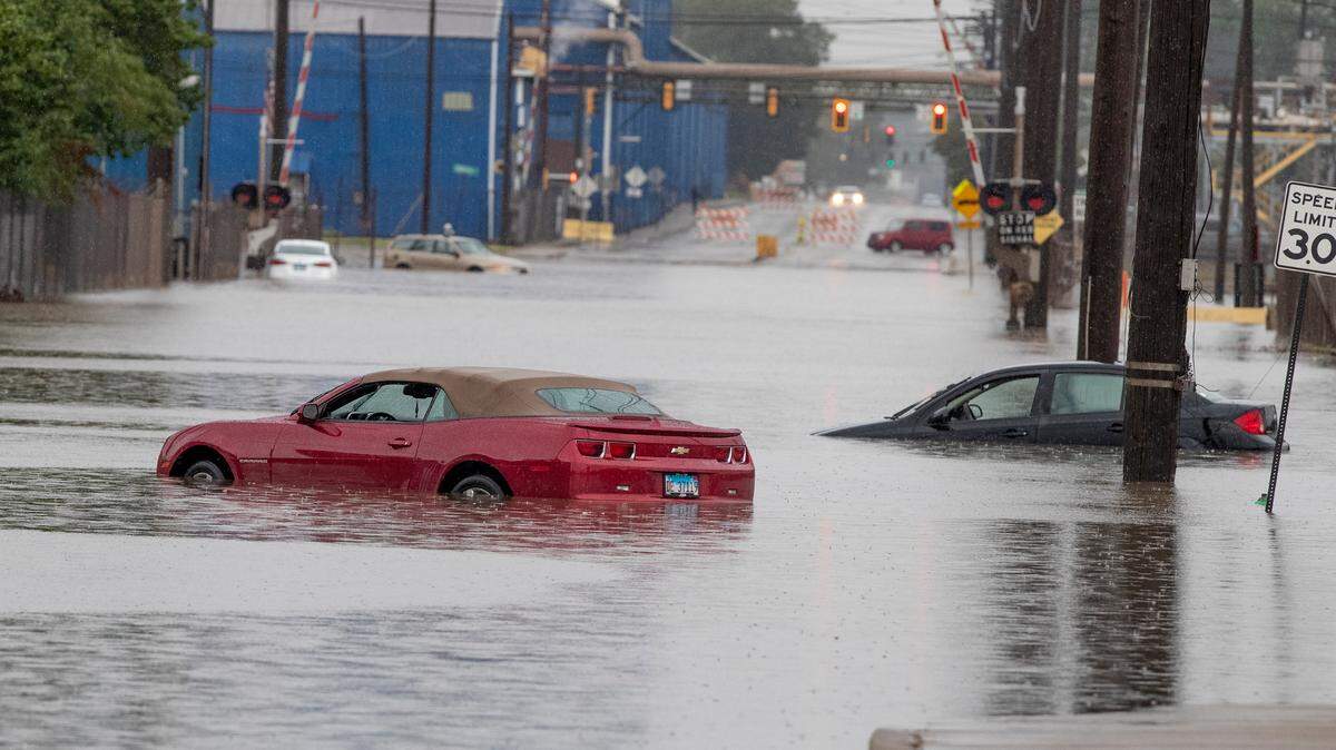
12:45 p.m. Death reported in St. Louis
The St. Louis Metropolitan Police Department reported one person apparently drowned in a car in floodwaters at the intersection of Skinker Boulevard and Rosedale Avenue Tuesday morning.
St. Louis Fire Chief Dennis Jenkerson said 8 1/2 feet of water flooded the area, according to a report by KSDK-Channel 5.
The victim’s name has not been released and officials don’t know if the person was already in the area or had driven into the water.
Jenkerson said at least 70 people have been rescued in the city, the television station reported.
Parts of Interstates 70, 64, 55 and 44 in the St. Louis area have been shut down at various times because of the flooding on Tuesday, The Associated Press said.
By noon, nearly 9 inches of rain had fallen at St. Louis Lambert International Airport to demolish the previous record of 6.85 inches set on Aug. 20, 1915, when remnants of the Galveston, Texas, hurricane hit St. Louis, the AP reported.
11:40 a.m. Metro gives public transportation update
“MetroBus, MetroLink and Metro Call-A-Ride customers continue to experience significant delays of 60 minutes or more due to flash flooding conditions on area roadways and on MetroLink tracks,” the agency said in a statement.
“MetroLink station shuttles are current transporting passengers by bus between the Lambert Airport Terminal #1 and Central West End stations, and between the Brentwood I-64 and Central West End stations.
“MetroLink trains are in operation between the Central West End and Shiloh-Scott Stations, and between the Shrewsbury-Lansdowne I-44 and Brentwood I-64 stations.
“MetroLink will operate on a 20-minute frequency until further notice.”
11:30 a.m. Update from the National Weather Service
The metro-east can expect to see rain fall through most of the afternoon, but lighter than the overnight and early morning hours, according to the National Weather Service of St. Louis.
Ben Herzog, a meteorologist with the NWS, said the area likely will see another quarter inch of rain through the rest of the morning and afternoon hours.
“We’re going to see rain continue to fall over the next few hours, but, fortunately, it will be much lighter than what we saw overnight and this morning,” he said Tuesday morning.
Herzog said the metro-east can expect to see scattered showers between noon and 4 p.m., and that the rain should be completely out of the area by 4 p.m.
“Some areas will see scattered showers, some areas won’t ... but 4 p.m. is a good estimate for when the rain will be completely out of the area,” Herzog said.
12:30 Rainfall amounts across the region
In southwest Illinois, rainfall amounts as of early this morning varied, from as low as .14 inches in Sparta and .38 inches in Red Bud to over 6 inches in Belleville, Cahokia Heights, Fairview Heights and Scott Air Force Base.
11:20 a.m. Belleville Fire Department reports on flooding
Deputy Chief Lance Phelps of the Belleville Fire Department said they are mainly hearing flooding on roads and streets, also some stranded vehicles.
“We did have at one structure fire already this morning at 1709 Golf Course Drive,” said Deputy Chief Phelps. “In this case, it was a single-family residence.”
There are no reported injuries.
Phelps said they are not 100 percent certain, but it does appear to be a lightning strike that started the fire.
At approximately 6:30 am this morning, Route 15 near Belleville crossing was flooded out, Phelps said.
Phelps said the fire department anticipates streets and roads being flooded out. He said they look for some drivers that pass through those areas and the car wind up getting stranded.
Phelps said they are on a car rescue around 9:35 am on West F Street and North Third Street.
Phelps recommends drivers to turn around if they see flooding on roads.
“Don’t try to navigate that high water situation, there’s no way you can tell what is going to happen,” Phelps said. “Cars are just not made for that.”
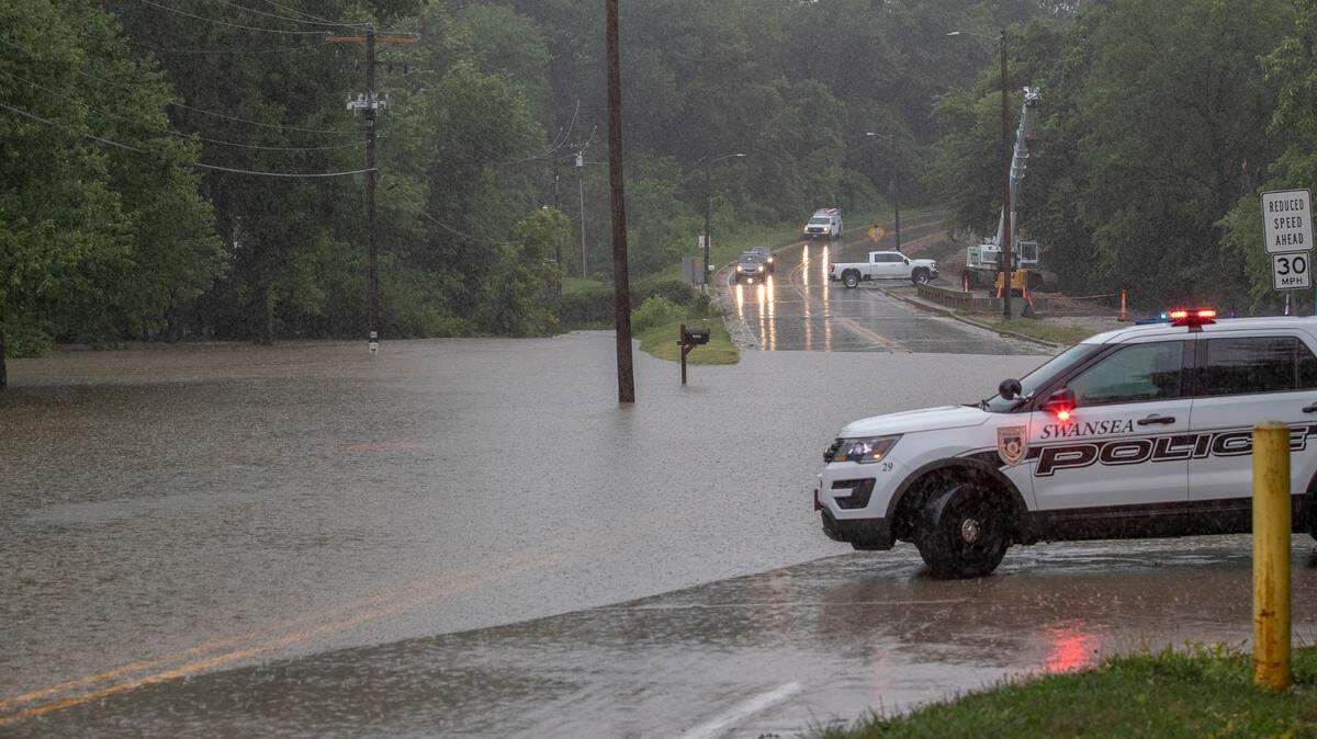
10:13 a.m. Swansea roads closed, water still rising
A Code Red Alert from the Village of Swansea calls rainfall amounts “unprecidented” and urges continued caution on the roads, where water continues to rise in some areas. Roads closed in the village include parts of Big Bend, South Old Collinsville, Lake Loraine, Anna and Fullerton.
“We anticipate more as water levels rise,” the emergency text to registered residents stated. “Slow down. Have a plan. Public safety officials and all Swansea public works personnel are on the streets working.”

10 a.m. Road closings in O’Fallon
The following roads are closed due to flooding in O’Fallon:
State Street between Lawn Avenue. and Countryside Lane
Old Collinsville Road between Fountains Parkway and Frontage Road
Highway 50 between O’Fallon and Lebanon
Bristlecone Drive between Pierce Boulevard.and Jeffrey Pine Court
Pierce Boulevard. between White Pine Avenue and English Pine Lane
Ponderosa Avenue between Pierce Boulevard and Red Pine Avenue
9:45 a.m. Nashville dam fails
The secondary dam of the Nashville reservoir has failed, the Washington County Illinois Emergency Management announced.
“Please prepare to evacuate if needed. You are in the potential flood zone. We will send out another alert if evacuation is imminent,” the agency announced.
“The primary dam is holding,” said Matt Bierman, the agency’s director, in an interview with the BND.
Bierman said the alert about a possible evacuation went to 101 households.
Elsewhere in the county, multiple roads were closed and Nashville firefighters had to perform one water rescue, Bierman said.
A list of road closures had not yet been compiled.
For more information, call the agency’s office at 618-327-4800, extension 340.
9 a.m. Animal shelter flooded
Dogs at the St. Clair County animal shelter are being relocated because water has entered the building at 1250 S. 11th St. in Belleville.
“We taking a busload of dogs out to the highway garage right now,” Simmons said. “Water came into the building so we’re going to relocate the animals.”
Simmons said it appears the building will be able to be repaired.

8:40 a.m. Scott Air Force Base update
Scott Air Force Base posted the following message on their Facebook page around 8:40 a.m.: “Due to continued flooding in and around the base, the base will now go to a Mission Essential reporting status today. All facility managers are asked to check on their buildings and report any damage to CE. For those in housing areas who experience flooding and damages, please report your issues to Hunt Housing. The Youth Center and CDC will now be closed.”
According to the Facebook post, the Belleville Gate was scheduled to reopen at 9 a.m.
7 a.m. Rainfall record set
The National Weather Service in St. Louis reported that the all-time daily rainfall record was set at the airport early Tuesday with 8.06 inches of rain by 7 a.m.
The previous record was Aug. 20, 1915, when 6.85 inches fell on one day when remnants of the Galveston, Texas, hurricane hit St. Louis.
6:59 a.m. SIUE closes a campus
Southern Illinois University Edwardsville announced Tuesday morning on Twitter that the East St. Louis campus would be closed until further noticed due to heavy rain and flooding.
BND staffers Mike Koziatek, Lexi Cortes, Todd Eschman, Carolyn P. Smith, Garen Vartanian, Ahmad Lathan, Derik Holtmann and DeAsia Paige contributed to this report.
This story was originally published July 26, 2022 at 8:32 AM.