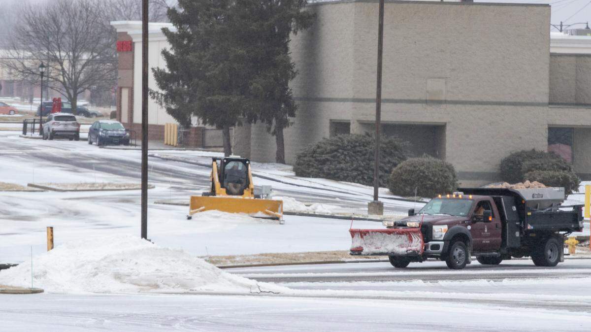
More than 6 inches of snow may fall this week in southwest Illinois. Here are the details
READ MORE
More coverage on Winter Storm Landon
Read all of the BND’s articles about Winter Storm Landon in the metro-east
Expand All
The metro-east area remains under a Winter Weather Watch with a forecast of snow and ice by mid-week..
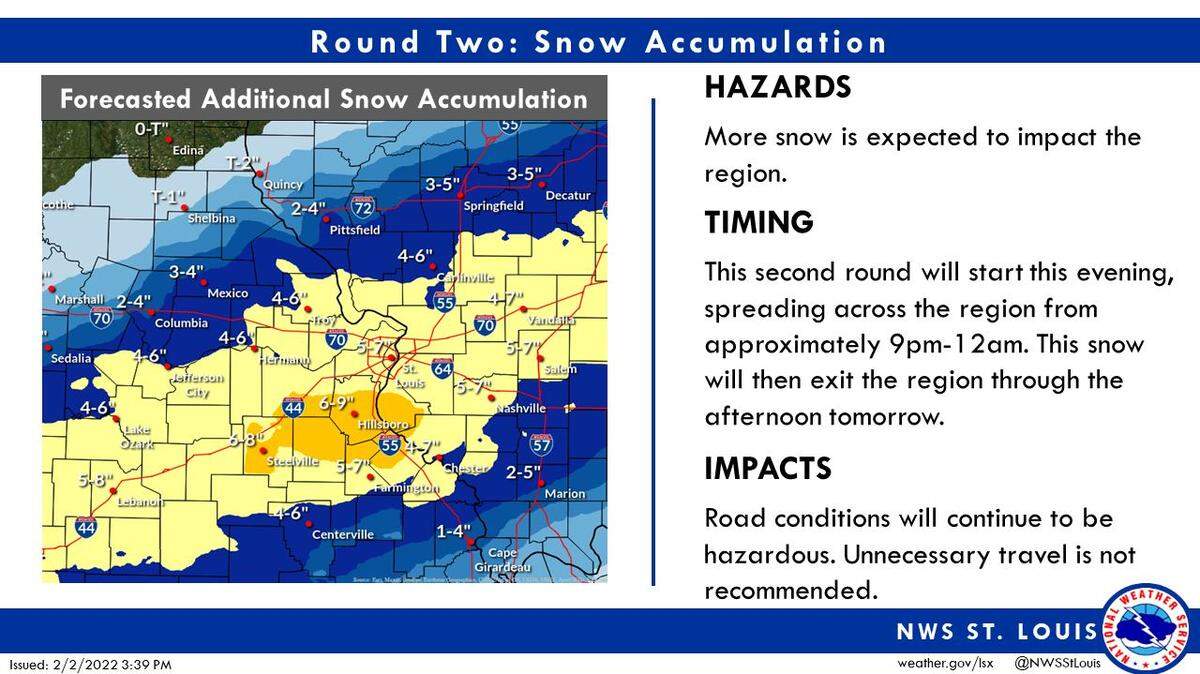
According to Jared Maples, a meteorologist with the National Weather Service of St. Louis, the metro-east can expect 0.10 inch of ice and up to 6-8 inches of snow.
Maples said the storm will begin as rain Tuesday into Tuesday night before transitioning into a mixture of freezing rain and/or sleet and then all snow Wednesday morning or as late as Wednesday afternoon, continuing until about noon Thursday. As of Monday afternoon, the entire situation was still fluid, Maples noted.
“Please be highly vigilant on what you look at from time to time with this being such a fluid, evolving system,” Maples advised. “If the cooler air arrives sooner, there could be higher snow totals. At this point, we’re leaning more towards sleet than freezing rain with how the atmospheric profile is setting up. Any time you get sleet or freezing rain that eats into snow totals.”
Maples said the current ice projections could cause weaker tree limbs to fall and some scattered power outages.
“If I were to visualize it, my concern would be how much snow and sleet are on top of the weight of the ice,” he said.
Maples expects the storm to wrap up around noon Thursday or shortly thereafter, noting the snow probability drops to 40% before tailing off to the east.
Warning vs. Watch
Maples also explained the difference between a Winter Storm Watch and a Winter Storm Warning.
“A watch is a situation where high impact winter weather is probable,” he said. “In the case of a watch, we see the information and if the ingredients come together right, there will be impactful weather. We are still wanting higher confidence on where things will land with specific places and times before upgrading to a warning.”
Regarding a warning, Maples noted, “That’s where you move into the higher tier that winter weather is imminent. That’s when all the data and things we’ve been looking at are not only consistent and the certainty is there that you’re going to have pretty impactful winter weather and that the weather is imminent.”
Stay home
Maples also said the entire area will receive similar snow/ice totals, whether north to Edwardsville or in Belleville.
“Things can change. It’s the nature of our geographic location,” he said. “In this scenario, just the depths of the cold air off to the northwest, any minor deviation 10-15 miles can make a huge difference on what areas to the northwest get vs. what areas to the southeast get. I don’t think numbers will vastly differ unless we get an evolution of cooler air into one of those areas.”
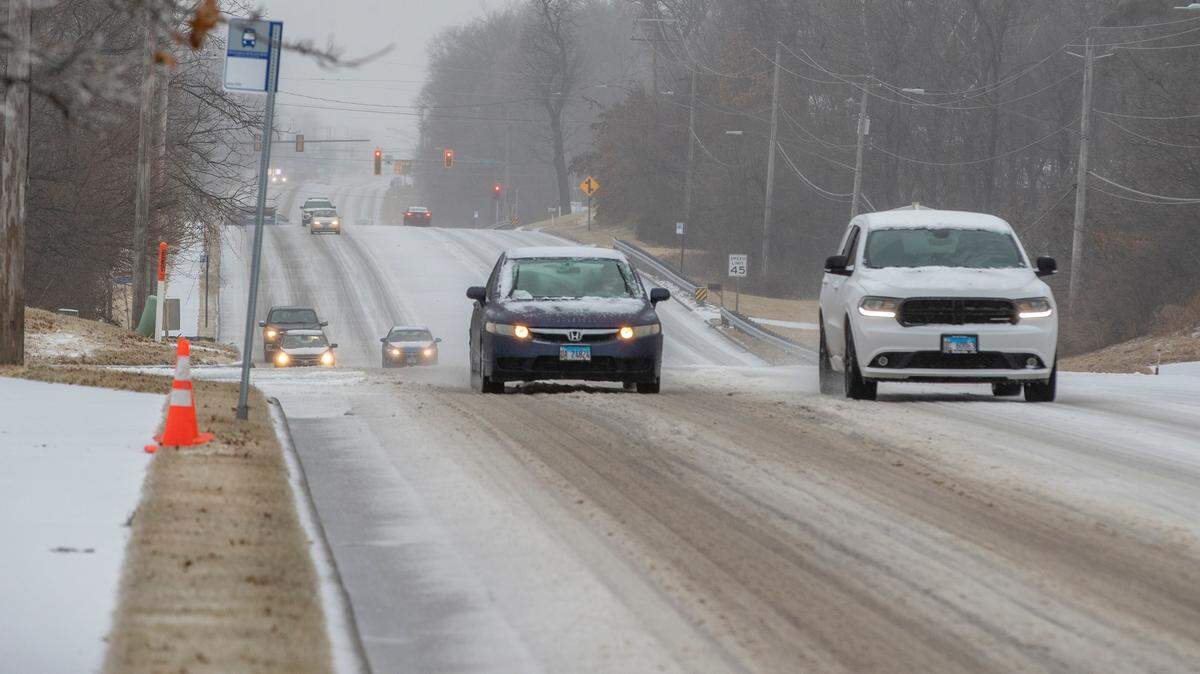
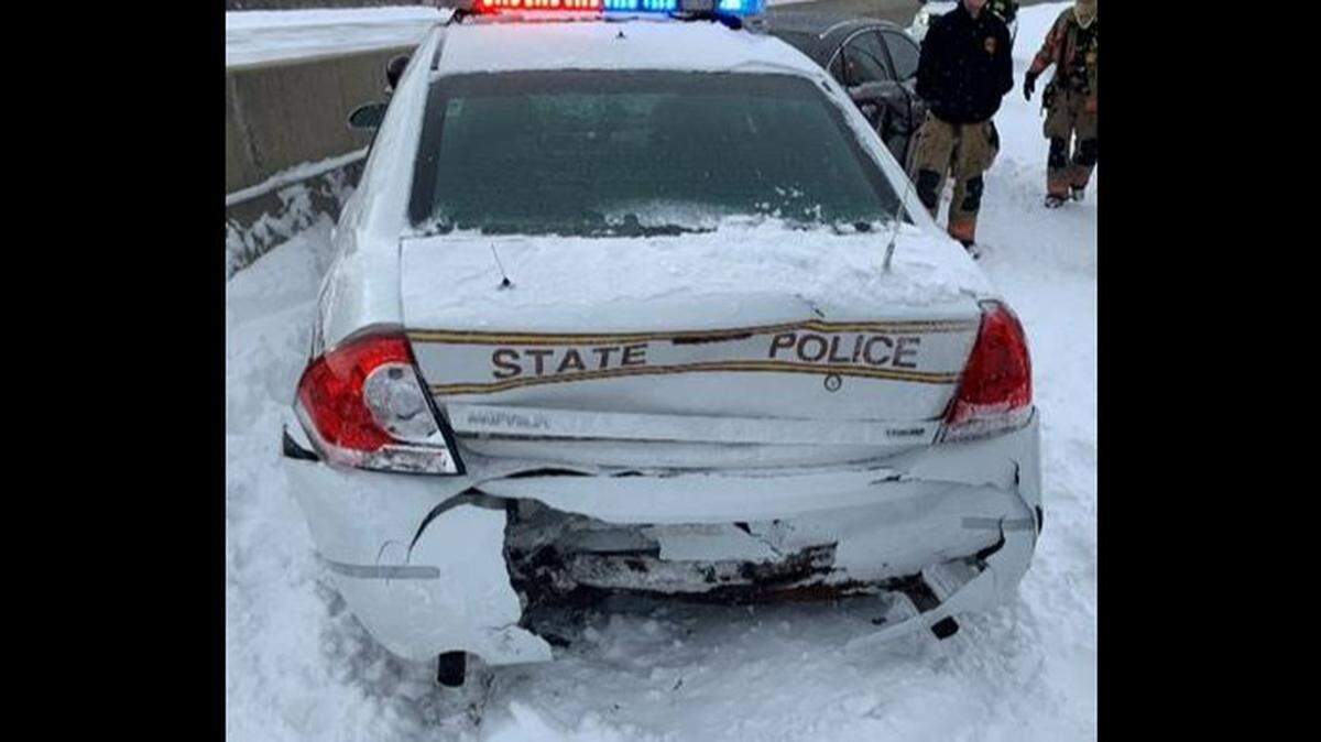
Finally, Maples warned people to just stay home if at all possible Wednesday and Thursday. He particularly noted the danger of being stranded on the road.
“This is one of those particularly special storms in the sense the amounts we have and amount of moisture are not real typical,” he said. “This is not going to be one of those things where you can’t just take it slow to work and you might get there ... this is one of those if you get out in it and the precipitation starts to transition it could come down at a good clip, and people who are out on the roads and not at their destination could get stranded.”
Sleet vs. snow
Maples also offered additional caution about driving in sleet. He said people sometimes make the mistake of equating sleet with snow.
“Sleet is much more dense than snow,” he said. “It’s much harder to drive in 2 inches of sleet than 2 inches of snow. It compacts much better. And once you get 1-2 inches of sleet it almost acts like a sheet of ice once it compacts into the ground and you get those sub-freezing temperatures to help it solidify.”
The National Weather Service recommends keeping up to date on the forecast the next couple days by visiting www.weather.gov.
This story was originally published January 31, 2022 at 6:14 PM.